The Flood Risk Management Plan (PGRA) is the reference operational tool of the District Basin Authority for mapping the areas at risk and at risk of flooding and for identifying the measures to be implemented to reduce the negative consequences of floods on human health, protection of the territory, cultural heritage and economic and social activities.
Regulatory framework
The Flood Risk Management Plan (PGRA) is provided for by Community Directive 2007/60/EC (so-called ‘Flood Directive’) and was implemented into the Italian legislative system with Legislative Decree no. 49/2010. The PGRA also constitutes the excerpt from the District Basin Plan, provided for by art. 65 of Legislative Decree 152/06, regarding floods.
The development of the Plan
The PGRA is developed by the District Basin Authority as it plays the role of primary Competent Authority for the purposes of the obligations related to the Floods Directive. The Basin Authority is supported by further authorities with different roles and functions, such as the Regions, the Ministry of the Environment and Energy Security, ISPRA and the Department of Civil Protection.
The development of the FRMPs is temporally organized according to planning cycles as the Directive requires that the Plans be reviewed and, if necessary, updated every six years. The first cycle was valid for the period 2015-2021.
The PGRA was first drafted in 2015 and is reviewed and updated every 6 years. The first update of the PGRA was drafted in 2021.
As required by the Floods Directive, each planning cycle is divided into the following phases:
-
- Preliminary assessment of flood risk and definition of areas of potential significant risk (APSFR)
- Hazard maps and flood risk maps
- Flood Risk Management Plan
With resolution no. 26 of 20 December 2021, the Permanent Institutional Conference, pursuant to articles 65 and 66 of Legislative Decree 152/2006, adopted the first update of the 2021-2027 flood risk management plan – second management cycle – of hydrographic district of the Northern Apennines, which was subsequently approved, pursuant to articles 57, 65 and 66 of the legislative decree of 3 April 2006, n. 152, with d.p.c.m. 1 December 2022, published in the Official Journal no. 31 of 7.02.2023.
The contents of the plan
The PGRA covers all aspects related to flood risk management: prevention, protection, preparation and restoration.
Prevention: includes regulatory actions on the use of land aimed at its correct use on the basis of flood danger, the regulation of the PGRA, the urban planning rules at regional and local level, the measures for the delocalisation and reallocation of elements at risk, activities aimed at improving knowledge of the territory.
Protection: includes the construction of structural or non-structural works, such as defense interventions (dams, embankments, expansion tanks, spillways, sea defences, etc.), actions to modify the river structure aimed at recovering the naturalness of the watercourse (recovery of floodplain areas, restoration of wetlands, etc.), maintenance interventions and hydraulic-forestry arrangements.
Preparation: includes actions aimed at improving the capacity of the population and the civil protection system to deal with events, forecasting, alerting, emergency management, population training and information activities, event pre-announcement and monitoring systems, the management protocols of defense works during the event phase, the civil protection plans.
Recovery: includes post-event actions for the return to normality and for the acquisition of information on the dynamics of the event and the related effects.
The first update of the Flood Risk Management Plan (PGRA 2021 – 2027) consists of the following documents:
- Plan Report and related annexes
- Piano Discipline
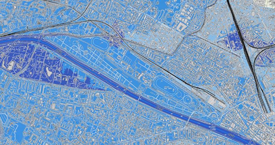
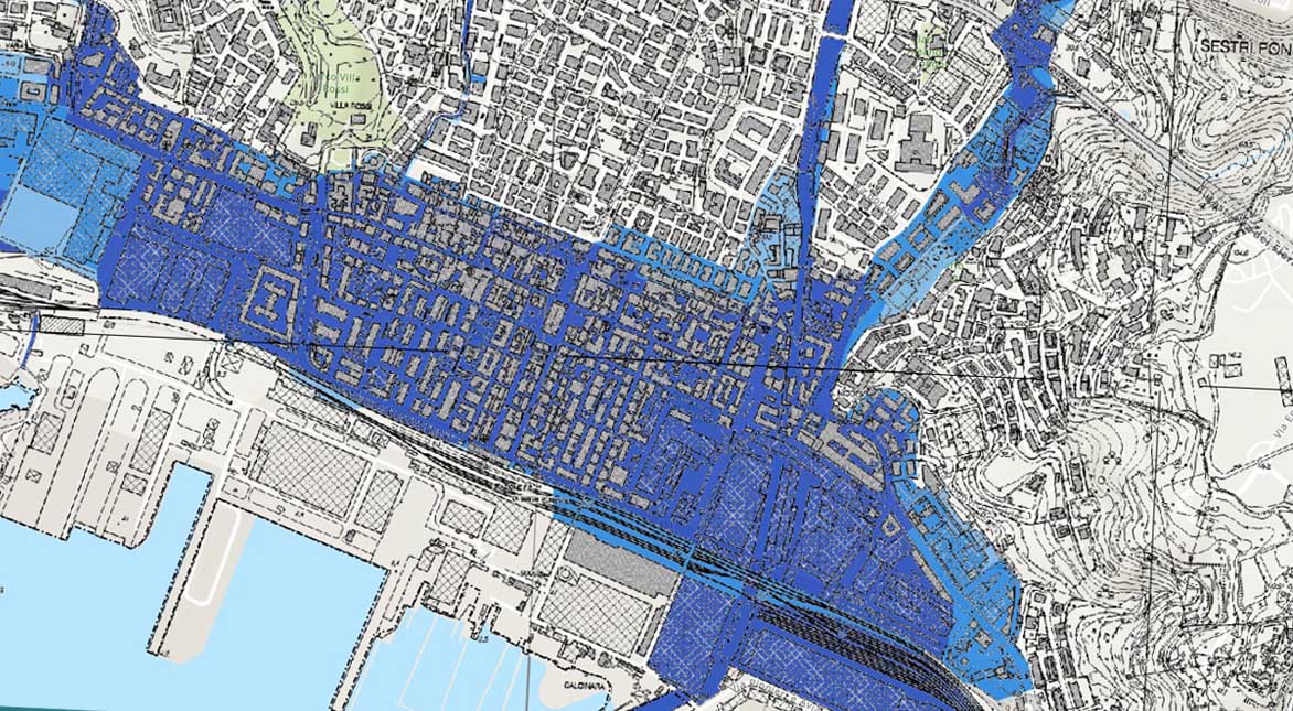
- River and coastal flood hazard map
- Flood risk map
- Map of protection measures
- Hazard map derived from flash flood phenomena
- The flood hazard map is constantly updated.

Altre pianificazioni vigenti in materia di rischio idraulico